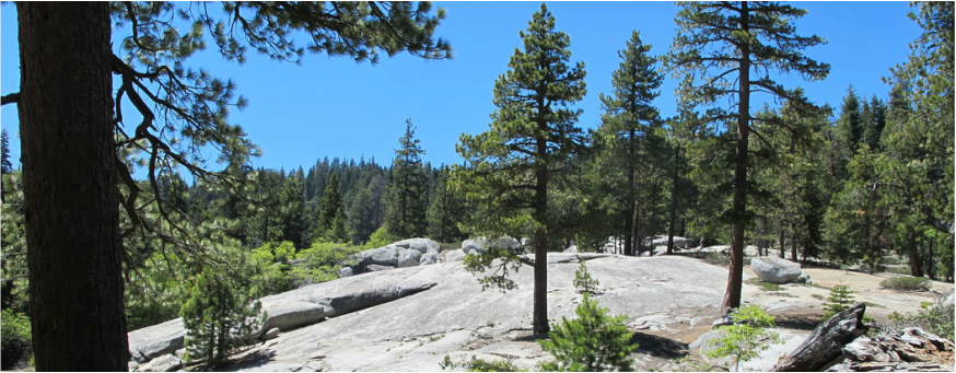
Teakettle Experimental Forest, California USA
Current Research Projects
Low cost multi-angle UAV photogrammetry for forest inventory and road assessment
Collaborators: Jim Graham, Kevin Boston, Sara Hanna, David Lamphear
Funding sources: L.W. Schatz Demostration Tree Farm, California State University Agricultural Research Initiative
Objective: Coming soon
Research Products:
Changes in forest vegetation and fuel conditions 15 years after prescribed fire
Collaborators: Malcolm North, Matthew Hurteau, Brandon Collins
Funding sources: Joint Fire Science Program
Objective: This research is focused on how vegetation and fuel conditions have responded spatially and temporally to prescribed fire over the past 15 years. This research is being conducted at the Teakettle Experimental Forest in the southern Sierra Nevada and will evaluate 1) how thinning and burning treatments have altered structural heterogeneity and understory plant cover and diversity; 2) how resilient the different treatments are to the on-going drought in California; 3) how local factors influence tree growth, mortality, and resilience to drought; and 4) how predicted fire behavior and effects vary 15 years after treatment.
Research Products:
Goodwin, M.J., North, M.P., Zald, H.S.J., & Hurteau, M.D. (2018). The 15-year post-treatment response of a mixed-conifer understory plant community to thinning and burning treatments. Forest Ecology and Management 429: 617-624.
Quantifying the carbon costs and benefits of maintaining fuel treatment effectiveness
Collaborators: Matthew Hurteau, Malcolm North, Robert York
Funding sources: CAL FIRE Greenhouse Gas Reduction Fund (GGRF) Demonstration State Forests Research
Objective: Previous research has demonstrated that fuel treatments, consisting of understory thinning and prescribed burning, can modify forest structure and fuel loads and reduce the risk of high-severity wildfire. However, single-entry fuels treatments have diminishing effectiveness over time and require the restoration of fire to maintain effectiveness. The purpose of this research is to improve our understanding of multiple prescribed fire for managing fire risk and how these fires influence forest carbon dynamics. The research is designed to answer three questions: 1) Are the emissions from a second-entry burn lower than the first-entry, thereby reducing the length of time required for treatment emissions to be resequestered? 2) Does a second-entry burn in the burn-only treatment produce the same post-treatment growth release and mortality patterns as the first-entry burn? 3) Is the growth response following the understory thinning treatment sustained through the current drought?
This research is being conducted at the Teakettle Experimental Forest in the southern Sierra Nevada.
Research Products:
Integrating multi-temporal Landsat imagery and tree-rings to quantify responses of forest productivity to climate change and drought stress in Northern California
Collaborators:
Funding sources: USDA National Institute of Food and Agriculture, California State University Agricultural Research Initiative
Objective: Quantification and prediction of forest growth and productivity is a prerequisite for scientifically-based forest management and climate change mitigation. Forest growth and productivity are widely predicted by applying empirical equations using explanatory variables such as tree size, age, and site productivity. These empirical relationships assume that site productivity (the combination of soil, topography, and climate) are static over time. Yet anthropogenic greenhouse gas emissions are changing average climate conditions and extreme climate events, both of which can alter forest productivity. For example, California is currently experiencing its most severe drought in 500 years, this drought has killed millions of trees, and climate projections suggest such drought conditions may represent the “new normal” of a warmer and drier region. While forest responses to the current California drought have been observed at many locations, a systematic understanding of how forest productivity responds to climate over time is needed at regional spatial scales to support forest inventory and monitoring, quantify future forest vulnerability, and inform forest policy and regulatory mechanisms. Numerous data sources exist (federal inventory plots, tree-ring data, satellite imagery) to quantify forest responses to climate and drought, but individually each has significant limitations for quantifying forest productivity in a spatially and temporally exhaustive manner. The goal of this research is to combine recent advances in multi-temporal Landsat satellite imagery processing with tree-ring data, leveraging the strengths of each data source to quantify and spatially predict changes in forest productivity in the Klamath Ecoregion of Northern California over the past three decades (1985-2016), quantifying both multi-decadal changes in productivity as well as growth responses to the ongoing California drought.
Research Products:
Influence of season and interval of prescribed burning on understory vegetation in ponderosa pine forests of the Blue Mountains, Oregon USA
Collaborators: Becky Kerns, Michelle Day
Funding sources: Joint Fire Science Program
Objective: Fire exclusion has dramatically altered historical fire regimes in dry conifer forests across western North America. Forest managers increasingly focus on reducing forest fuels with mechanical thinning and/or prescribed burning. These treatments often have additional objectives such as restoring forest composition, structure, and ecosystem processes. Of particular interest in this research is how understory vegetation in ponderosa pine forests may respond to different season and intervals of prescribed burning (SIB). SIB is often determined by operational constraints rather than historical fire regimes, potentially resulting in fire conditions and burn intervals to which native plants are poorly adapted. The purpose of this research is to understand how understory vegetation has responded to season (Fall vs. Spring) and interval (5 vs. 15 year) prescribed burning in thinned ponderosa pine forests on the Malheur National Forest of eastern Oregon, Specifically, we are focusing on how species richness and diversity, compositional change, and indicator species change over time with different SIB levels.
Research Products:
Interactive effects of pine butterfly defoliation and prescribed burning on growth of Ponderosa pine forests in the Blue Mountains, Oregon USA
Collaborators: Becky Kerns, Doug Westlind
Funding sources: Joint Fire Science Program
Objective: Under construction
Research Products:
Past Research Projects
Disentangling the drivers of wildfire severity in a multi-owner landscape, southwestern Oregon USA
Collaborators: Chris Dunn, John Bailey
Funding sources: Bureau of Land Management
Objective: Fuels are the only component of the fire triangle that forest and fire managers can alter to change fire behavior. There have been numerous studies examining how fuel reduction treatments and salvage logging alter fire behavior, severity, and its’ ecological impacts. However, less attention has been paid to how different forest management objectives may influence fire severity in multi-owner landscapes, despite costly and politically contentious suppression of wildfires that do not acknowledge ownership boundaries. In 2013, the Douglas Complex burned over 30,000 ha of Oregon & California Railroad (O&C) lands in Southwestern Oregon, USA. The O&C lands are a geographic checkerboard of private industrial and federal forest land with fundamentally different management objectives, subsequent forest conditions, and perceived fire risks, providing a unique opportunity to quantify the effects of forest management practices on wildfire severity. We are bringing together geospatial data on fire progression, fire weather, topography, pre-fire forest conditions, and past management activities to represent the different factors that influence fire behavior. Using ensemble machine learning and spatial modelling techniques, This research is designed to ask two questions 1) what is the relative importance of different factors (fuels, topography, and weather) on fire severity (RdNBR, relative differenced normalized burn ratio, as calculated from Landsat 8 OLI imagery)?, and 2) what effect does forest management have on fire severity?
Research Products:
Zald, H.S.J., & Dunn, C.J.. (2018). Severe fire weather and intensive forest management increase fire severity in a multi-ownership landscape. Ecological Applications. 0(0). 1-13.
Integrating Landsat pixel composites and change metrics with lidar plots to predictively map forest structure and above ground biomass in Saskatchewan, Canada
Collaborators: Mike Wulder, Thomas Hilker, Joanne White, Georgie Hobart, Txomin Hermosilla, Nicholas Coops
Funding sources: Natural Resources Canada
Objectives: Forest inventory and monitoring programs are needed to provide timely, spatially complete (i.e. mapped), and verifiable information to support forest management, policy formulation, and reporting obligations. Satellite images, in particular data from the Landsat Thematic Mapper and Enhanced Thematic Mapper (TM/ETM +) sensors, are often integrated with field plots from forest inventory programs, leveraging the complete spatial coverage of imagery with detailed ecological information from a sample of plots to spatially model forest conditions and resources. However, in remote and unmanaged areas such as Canada's northern forests, financial and logistic constraints can severely limit the availability of inventory plot data. Additionally, Landsat spectral information has known limitations for characterizing vertical vegetation structure and biomass; while clouds, snow, and short growing seasons can limit development of large area image mosaics that are spectrally and phenologically consistent across space and time. In this study we predicted and mapped forest structure and aboveground biomass over 37 million ha of forestland in Saskatchewan, Canada. We utilized lidar plots—observations of forest structure collected from airborne discrete-return lidar transects acquired in 2010—as a surrogate for traditional field and photo plots. Mapped explanatory data included Tasseled Cap indices and multi-temporal change metrics derived from Landsat TM/ETM + pixel-based image composites. Maps of forest structure and total aboveground biomass were created using a Random Forest (RF) implementation of Nearest Neighbor (NN) imputation.
Research Products:
Matasci, G., Hermosilla, T., Wulder, M.A., White, J.C., Coops, N.C., Hobart, G.W., & Zald, H.S.J. (2017). Large-area mapping of Canadian boreal forest cover, height, biomass, and other structural attributes using Landsat composites and lidar plots. Remote Sensing of Environment, 209. 90-106.
Matasci, G., Hermosilla, T., Wulder, M.A., White, J.C., Hobart, G.W., Zald, H.S.J., & Coops, N.C. (2017). A space-time data cube: Multi-temporal forest structure maps from Landsat and LiDAR. Geoscience and Remote Sensing Symposium (IGARSS), 2017 IEEE International. 10.1109/IGARSS.2017.8127523
Zald, H. S., Wulder, M. A., White, J. C., Hilker, T., Hermosilla, T., Hobart, G. W., & Coops, N. C. (2016). Integrating Landsat pixel composites and change metrics with lidar plots to predictively map forest structure and aboveground biomass in Saskatchewan, Canada. Remote Sensing of Environment, 176, 188-201.
Using lidar and Landsat disturbance metrics to improve imputation maps of forest vegetation composition and structure
Collaborators: Janet Ohmann, Heather Roberts, Matt Gregory, Emilie Henderson, Robert McGaughey, Justin Braaten
Funding sources: WWETAC, U.S. Forest Service Pacific Northwest Research Station
Objectives: This study investigated how lidar-derived vegetation indices, disturbance history from Landsat time series (LTS)
imagery, plot location accuracy, and plot size influenced accuracy of statistical spatial models (nearest-neighbor imputation maps) of forest vegetation composition and structure. Nearest-neighbor (NN) imputation maps were developed for 539,000 ha in the central Oregon Cascades, USA. Mapped explanatory data included tasseled-cap indices and disturbance history metrics (year, magnitude, and duration of disturbance) from LTS imagery, lidar derived vegetation metrics, climate, topography, and soil parent material. Vegetation data from USDA Forest Service forest inventory plots was summarized at two plot sizes (plot and subplot) and geographically located with two levels of accuracy (standard and improved). Maps of vegetation composition and structure were
developed with the Gradient Nearest Neighbor (GNN) method of NN imputation using different combinations of explanatory variables, plot spatial resolution, and plot positional accuracy. The primary objective of this study was to determine if lidar and LTS disturbance metrics can improve the accuracy of regional NN imputation maps of forest vegetation composition and structure. An additional objective of this study was to determine if plot location accuracy and plot size influenced prediction accuracy of NN imputation maps.
Research Products:
Zald, H. S., Ohmann, J. L., Roberts, H. M., Gregory, M. J., Henderson, E. B., McGaughey, R. J., & Braaten, J. (2014). Influence of lidar, Landsat imagery, disturbance history, plot location accuracy, and plot size on accuracy of imputation maps of forest composition and structure. Remote Sensing of Environment, 143, 26-38.
Drivers of aboveground live carbon density at the H.J. Andrews Experimental Forest, Oregon, USA
Collaborators: Thomas Spies, Rupert Seidl, Rob Pabst, Keith Olsen, E. Ashley Steel
Funding sources: NSF LTER Program
Objectives: Forest carbon (C) density varies tremendously across space due to the inherent heterogeneity of forest ecosystems. Variation of forest C density is especially pronounced in mountainous terrain, where environmental gradients are compressed and vary at multiple spatial scales. Additionally, the influence of environmental gradients may vary with forest age and developmental stage, an important consideration as forest landscapes often have a diversity of stand ages from past management and other disturbance agents. Quantifying forest C density and its underlying environmental determinants in mountain terrain has remained challenging because many available data sources lack the spatial grain and ecological resolution needed at both stand and landscape scales. The objectives of this study were to integrated aerial light detection and ranging (lidar) data with field plots to map forest ALC density at a grain of 25 m across the H.J. Andrews Experimental Forest, and determine if environmental factors influencing aboveground live carbon (ALC) density differed between young versus old forests.
Research Products:
Zald, H. S., Spies, T. A., Seidl, R., Pabst, R. J., Olsen, K. A., & Steel, E. A. (2016). Complex mountain terrain and disturbance history drive variation in forest aboveground live carbon density in the western Oregon Cascades, USA. Forest Ecology and Management, 366, 193-207.
Climate driven tree invasion of mountain meadows in Oregon, USA
Collaborators: Thomas Spies, Manuela Huso, Demetrios Gatziolis
Objectives: Under construction
Research Products:
Zald, H. S., Spies, T. A., Huso, M., & Gatziolis, D. (2012). Climatic, landform, microtopographic, and overstory canopy controls of tree invasion in a subalpine meadow landscape, Oregon Cascades, USA. Landscape Ecology, 27(8), 1197-1212.
Zald, H. S. (2009). Extent and spatial patterns of grass bald land cover change (1948–2000), Oregon Coast Range, USA. Plant Ecology, 201(2), 517-529.
